 FA+
FA+
215
Views
Views
2
Favorites
Favorites
Category
Photography / Human
Species Unspecified / Any
Size 1280 x 720
File Size 226 kB
Report this content
More from EthylTheAardvark

")
")
")
")


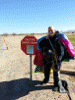
I'm starting to jump with other wingsuiters. I'm pretty sure this is how it starts. Some belly jumper gets a wingsuit, does some solo jumps, starts jumping with more wingsuiters and that's the last we see of them. They never come back and do belly, freefly or tracking jumps.
Aah, I still have fun with a good belly formation group, though. I kind of suck at it, but I don't get much practice either. I guess there's plenty of time to do both!
Aah, I still have fun with a good belly formation group, though. I kind of suck at it, but I don't get much practice either. I guess there's plenty of time to do both!
Category Photography / Human
Species Unspecified / Any
Size 1280 x 720px
File Size 226 kB

My house is a bit too far away and a bit too small to really do that. The building for a previous job is just to the right of Erin's head, though. See that lighter patch, and then the two white buildings? Just to the right of the second white building is where I used to work. There are three darkened glass skylights on the building that you can just barely see.
If you follow that road Erin's intersecting toward me, there's a coffee shop I like to get coffee at the next intersection. Even though the building houses several stores, it's too small to really see here.
The big complex between the airport and that road is Amgen. I believe they used to make insulin or something, there.
Almost directly below me is the Seagate building. I'd love to get a job there. I could do a jump before work and land at the office!
Just to the right and up from that is a running track that I use as a landmark.
It takes a while for your eyes to adapt to what the world looks like at that altitude. Fortunately, here, Long's Peak is an easy landmark to orient on when you're starting out. After a while, I started to pick out landmarks on the ground, too. Naturally the runway is always best, if you can see it clearly.
If you browse google maps at https://goo.gl/maps/i8zuz you can see these features more clearly. Click the satellite layer on -- I've put the star almost directly over the arrow that tells us the direction to land in. If you zoom in enough, the arrow will tell you the direction the wind was blowing from (It points directly into the wind) on the day the satellite image was taken.
Comments